 NOAA Satellite Tracks (13mb)
NOAA Satellite Positions and Tracks
Description:
NOAA has four POES, Polar Operational Environmental Satellites, currently in orbit. The satellites are named chronologically, based on launch date. NOAA 15 was launched in 1998, NOAA 16 was launched in 2000, NOAA 17 was launched in 2002 and NOAA 18 was launched in 2005. In May and August of 2007 two older satellites, NOAA 14 and NOAA 12 respectively, were decommissioned. These satellites orbit the Earth in such a way that they pass over the poles. Each orbit takes approximately 102.1 minutes, allowing the satellites to circle the Earth about 14.1 times each day. The polar orbit enables the satellites to collect daily global data for land, ocean, and atmospheric applications. This data is used a large variety of environmental monitoring applications such as weather analysis and forecasting, climate research and prediction, global sea surface temperature measurements, ocean dynamics research, global vegetation analysis and many other applications.
 NOAA Satellite Positions
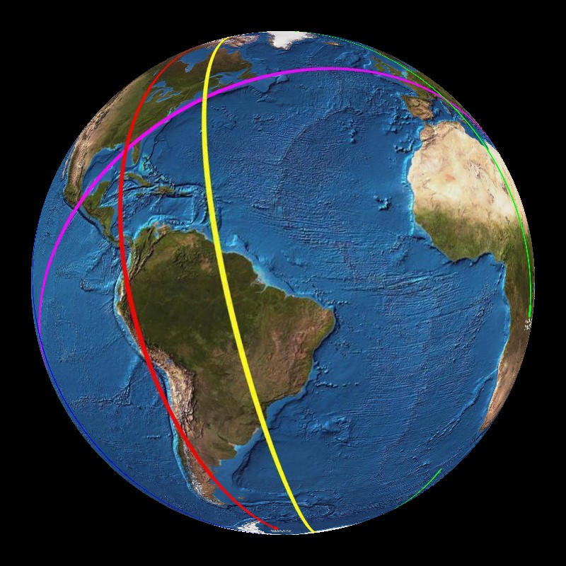
Two of the satellites are classified as A.M. satellites and the other two are classified as P.M. satellites, which indicate the time that they cross the equator. These satellites provide full global coverage four times daily. All of the satellites orbit the Earth at an altitude of over 500 miles. The NOAA satellites are managed by NESDIS, the National Environmental Satellite, Data and Information Service. Two datasets are available with the NOAA POES. The first shows their positions and the second shows their tracks. NOAA 15 is yellow, NOAA 16 is red, NOAA 17 is green, NOAA 18 is blue and the International Space Station is also included and is shaded pink.
Notable Features:
- NOAA 15 - yellow, NOAA 16 - red, NOAA 17 - green, NOAA 18 - blue, International Space Station - pink
- Polar orbit allows satellites to circle globe 14.1 times daily
Data Category
Major: Atmosphere
Keywords:
Atmosphere, NOAA, satellites, polar orbit
| Data Set Name | NOAA Satellite Positions |
| Data Set Directory Name | noaa_sat/position |
| Data Set Source | Jim Love, University of Colorado |
| Data Set Developer | Jim Love, University of Colorado |
| Visualization Developer | Mike Biere, NOAA/GSD |
| Audio | No |
| Contact | Jim Love, University of Colorado |
| Download | FTP |
| Data Set Name | NOAA Satellite Tracks |
| Data Set Directory Name | noaa_sat/tracks |
| Data Set Source | Jim Love, University of Colorado |
| Data Set Developer | Jim Love, University of Colorado |
| Visualization Developer | Mike Biere, NOAA/GSD |
| Audio | No |
| Contact | Jim Love, University of Colorado |
| Download | FTP |