 ETOPO1 (9 mb)
ETOPO1
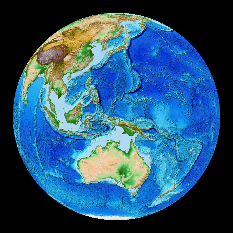
Description:
ETOPO1 is a 1 arc-minute global relief model of Earth's surface that integrates land topography and ocean bathymetry. It was built from numerous global and regional data sets, and is available in "Ice Surface" (top of Antarctic and Greenland ice sheets) and "Bedrock" (base of the ice sheets) versions. The "Ice Surface" version is available for Science On a Sphere®. This dataset is a higher resolution version of ETOPO2, which is a 2 arc-minute global relief model of Earth's surface. An arc-minute is 1/60 of a degree. Scientists use high resolution maps like ETOPO1 to improve accuracy in tsunami forecasting, modeling, and warnings, and also to enhance ocean circulation modeling and Earth visualization. For more information on the creation of the map visit: NOAA NGDC ETOPO1
See the ETOPO2 datasets here
Notable Features:
- Mount Everest: tallest point on Earth at 29,035 ft
- Marianas Trench: deepest point on Earth at 36,201 ft
- Mountain Ranges: Himalayas, Rockies, Andes, Alps
- Global mid-oceanic ridge system: longest mountain range
Data Category
Land
Keywords:
Land, ETOPO1, bathymetry, topography
| Data Set Name | Etopo1 |
| Data Set Directory Name | etopo1 |
| Data Set Source | NOAA NGDC |
| Data Set Developer | C. Amante and B.W. Eakins, NOAA NGDC |
| Visualization Developer | Jesse Varner and Elliot Lim, NOAA NGDC |
| Audio | No |
| Download | FTP |
| Google Earth | KMZ file |