Age of the Sea Floor
Description:
The surface of the Earth is composed of a mosaic tectonic plates moving with respect to each other. The Earth is made of seven major plates and several smaller plates. As the plates move, new sea floor can be created. The plates form three different kinds of boundaries: convergent, divergent, and transform. Convergent boundaries are also called collision boundaries because they are areas where two plates collide. At transform boundaries, the plates slide and grind past one another. The divergent boundaries are the areas where plates are moving apart from one another. Where plates move apart, new crustal material is formed from molten magma from below the Earth's surface. Because of this, the youngest sea floor can be found along divergent boundaries, such as the Mid-Atlantic Ocean Ridge. The spreading, however, is generally not uniform causing linear features perpendicular to the divergent boundaries.
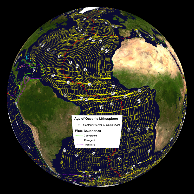
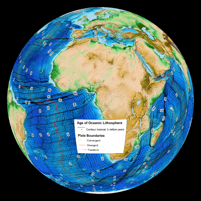
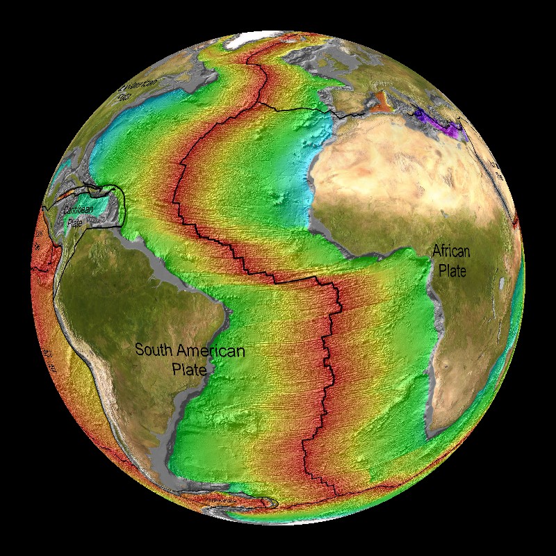
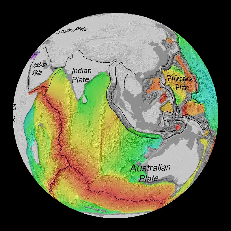
This dataset shows the age of the ocean floor along with the labeled tectonic plates and boundaries. The data is from four companion digital models of the age, age uncertainty, spreading rates and spreading asymmetries of the world's ocean basins. Scientists use the magnetic polarity of the sea floor to determine the age. Very little of the sea floor is older than 150 million years. This is because the oldest sea floor is subducted under other plates and replaces by new surfaces. The tectonic plates are constantly in motion and new surfaces are always being created. This continual motion is evidenced by the occurrence of earthquakes and volcanoes. There are four versions of this dataset, the first and second have the sea floor colored based on age while third and fourth have contour lines of the equal age. The first has the land shaded gray with topograpy and the second with the land shaded based on vegetation. The third dataset has yellow contour lines and the fourth has black contour lines.
 Age of the Seafloor iso lines yellow
 Age of the Seafloor iso lines black
Notable Features:
- The Mid-Atlantic Ocean Ridge is young ocean floor
- All of the tectonic plates are labeled
- For the datasets with contour lines, the plate boundaries are labeled
Data Category
Major: Land
Keywords:
Land, earthquakes, tectonic plates
| Data Set Name | Age of the Sea Floor with Topography and 20my contours |
| Data Set Directory Name | sea_floor_age/topo |
| Data Set Source | School of Geosciences, University of Sydney, Audstralia via NOAA's National Geophysical Data Center |
| Data Set Developer | Muller, R.D., M. Sdrolias, C. Gaina, and W.R. Roest |
| Visualization Developer | Elliot Lim, NOAA/NGDC |
| Audio | No |
| Contact | Elliot Lim, NOAA/NGDC |
| Download | FTP |
| Google Earth | KML file |
| Data Set Name | Age of the Sea Floor with Shaded Vegetation and 20my contour |
| Data Set Directory Name | sea_floor_age/shaded_veg |
| Data Set Source | School of Geosciences, University of Sydney, Audstralia via NOAA's National Geophysical Data Center |
| Data Set Developer | Muller, R.D., M. Sdrolias, C. Gaina, and W.R. Roest |
| Visualization Developer | Elliot Lim, NOAA/NGDC |
| Audio | No |
| Contact | Elliot Lim, NOAA/NGDC |
| Download | FTP |
| Google Earth | KML file |
| Data Set Name | Age of the Seafloor iso lines black |
| Data Set Directory Name | sea_floor_age/iso_lines_black |
| Data Set Source | School of Geosciences, University of Sydney, Audstralia via NOAA's National Geophysical Data Center |
| Data Set Developer | Muller, R.D., M. Sdrolias, C. Gaina, and W.R. Roest |
| Visualization Developer | Jesse Varner, NOAA/NGDC |
| Audio | No |
| Contact | Jesse Varner, NOAA/NGDC |
| Download | FTP |
| Date Added | April 2010 |
| Data Set Name | Age of the Seafloor iso lines yellow |
| Data Set Directory Name | sea_floor_age/iso_lines_yellow |
| Data Set Source | School of Geosciences, University of Sydney, Audstralia via NOAA's National Geophysical Data Center |
| Data Set Developer | Muller, R.D., M. Sdrolias, C. Gaina, and W.R. Roest |
| Visualization Developer | Jesse Varner, NOAA/NGDC |
| Audio | No |
| Contact | Jesse Varner, NOAA/NGDC |
| Download | FTP |
| Date Added | April 2010 |


 Age of the Sea Floor with Shaded Vegetation and 20my contours (10 mb)
 Age of the Sea Floor with Topography and 20my contours (8 mb)