 Volcano Locations Globally (23 mb)
Global Volcano Locations
Description:
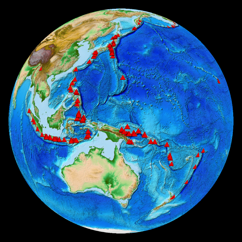
According to the Smithsonian Institute's Global Volcanism Program, there are probably about 20 volcanoes erupting right now, and about 550 volcanoes have had historically documented eruptions. A volcano is an opening, or rupture, in the Earth's crust through which molten lava, ash, and gases are ejected. Volcanoes typically form in three different settings. The first is divergent plate boundaries, where tectonic plates are pulling apart from one another, such as the Mid-Atlantic Ocean Ridge. Most of these volcanoes are on the bottom of the ocean floor and are responsible for creating new sea floor. The second location is convergent plate boundaries, where two plates, typically an oceanic and continental plate, are colliding. The volcanoes along the Pacific Ring of Fire are from convergent plate boundaries. The third location is over hotspots, which are typically in the middle of tectonic plates and caused by hot magma rising to the surface. The volcanoes on Hawaii are the result of hotspots.
 Volcano Eruptions (22 mb)
There are three datasets for Science On a Sphere that highlight global volcano locations. The first dataset, compiled by the Smithsonian Institute's Global Volcanism Program, shows the locations of current and past activity for all volcanoes on the planet active during the last 10,000 years. The other two datasets are from the National Geophysical Data Center's Significant Volcanic Eruption Database. One shows the locations of significant eruptions, of which there are over 400. An eruption if considered significant if there are any fatalities linked to it, the cost of the damage is over one million dollar, it causes a tsunami or there is a major earthquake associated with it. The final dataset shows the locations of all eruptions that have caused tsunami.
Notable Features:
- Most volcanoes occur along convergent boundaries
- There have been about 1300 know eruptions in the last 10,000 years
- There have been over 400 significant eruptions
- There have been 110 eruptions that caused tsunamis
 Volcano Eruptions causing Tsunamis (21 mb)
Data Category
Major: Land
Keywords:
Land, satellite, water, anomaly, climate change
| Data Set Name | Volcano Locations Globally |
| Data Set Directory Name | volcanoes/global_volcanoes |
| Data Set Source | Smithsonian Institute's Global Volcanism Program |
| Data Set Developer | Smithsonian Institute's Global Volcanism Program |
| Visualization Developer | Barry Eakins, NOAA NGDC |
| Audio | No |
| Download | FTP |
| Date Added | April 2010 |
| Data Set Name | Volcano Eruptions |
| Data Set Directory Name | volcanoes/eruptions |
| Data Set Source | National Geophysical Data Center's Significant Volcanic Eruption Database |
| Data Set Developer | National Geophysical Data Center's Significant Volcanic Eruption Database |
| Visualization Developer | Barry Eakins, NOAA NGDC |
| Audio | No |
| Download | FTP |
| Date Added | April 2010 |
| Data Set Name | Volcano Eruptions causing Tsunamis |
| Data Set Directory Name | volcanoes/tsunami |
| Data Set Source | National Geophysical Data Center's Significant Volcanic Eruption Database |
| Data Set Developer | National Geophysical Data Center's Significant Volcanic Eruption Database |
| Visualization Developer | Barry Eakins, NOAA NGDC |
| Audio | No |
| Download | FTP |
| Date Added | April 2010 |