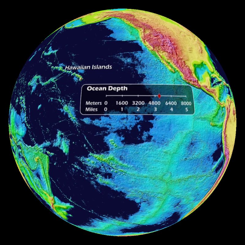
 Ocean Drain with Etopo Background (1 mb)
Ocean Draining
Description:
Beneath the sea surface is an amazing sea floor that contains mountain ranges, trenches and plains. The ocean covers 71% of the Earth's surface, has an area of 139,400,000 square miles and an average depth of 2.3 miles. Due to this vast size, only a few percent the sea floor has been mapped by ships. Maps of the sea floor are created by combining soundings from ships, sonar scans from ships, and gravity anomalies in the sea surface detected by satellites.
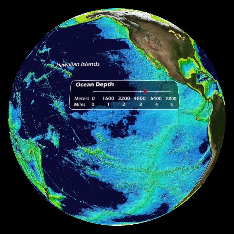 Ocean Drain with Land Background (1 mb)
This dataset gradually reveals the sea floor as the ocean is "drained." The scale in the dataset shows the distance below sea level in meters and miles. As selected features are revealed, a label appears. For this animation, the labeled areas include Mariana Trench, Tonga Trench, Puerto Rico Trench, Hawaiian Islands, Grand Banks, Mid-Atlantic Ridge and Ninety East Ridge. The deepest area in the ocean is the Mariana Trench, which is 6.86 miles (11,033 meters) deep. The longest mountain range in the world is the Mid-Atlantic Ridge, which runs through the middle of the Atlantic Ocean. There are two versions on this dataset that are fully labeled with a colorized seafloor based on bathymetry, one with the land shaded in true color and one with the land shaded based on elevation. A third version of this dataset is available with no labels and the land shaded in true color with the oceans shaded gray.
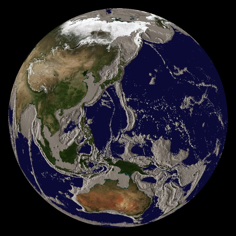 Ocean Drain with Gray Ocean Floor (1 mb)
Notable Features:
- Several prominent ridges and trenches are identified
- The scale shows the distance below sea level in meters and miles
- The deepest part of the ocean is in the Mariana Trench at 6.86 miles below sea level
Data Category
Major: Ocean
Keywords:
Ocean, sea floor, topography, mapping
| Data Set Name | Ocean Drain with Etopo Background |
| Data Set Directory Name | ocean_drain/etopo |
| Data Set Source | Walter Smith, NOAA |
| Data Set Developer | Walter Smith, NOAA |
| Visualization Developer | Dan Pisut, NOAA Environmental Visualization Lab |
| Audio | No |
| Contact | Walter Smith |
| Download | FTP |
| Date Added | July 2010 |
| Data Set Name | Ocean Drain with Land Background |
| Data Set Directory Name | ocean_drain/land |
| Data Set Source | Walter Smith, NOAA/NESDIS |
| Data Set Developer | Walter Smith, NOAA/NESDIS |
| Visualization Developer | Dan Pisut, NOAA Environmental Visualization Lab |
| Audio | No |
| Contact | Walter Smith, NOAA/NESDIS |
| Download | FTP |
| Date Added | July 2010 |
| Data Set Name | Ocean Drain with Gray Ocean Floor |
| Data Set Directory Name | ocean_drain/gray |
| Data Set Source | Walter Smith, NOAA/NESDIS |
| Data Set Developer | Walter Smith, NOAA/NESDIS |
| Visualization Developer | Dan Pisut, NOAA Environmental Visualization Lab |
| Audio | No |
| Contact | Walter Smith, NOAA/NESDIS |
| Download | FTP |
| Date Added | August 2011 |