 Geostationary Satellites (2 mb)
Geostationary Satellites
Description:
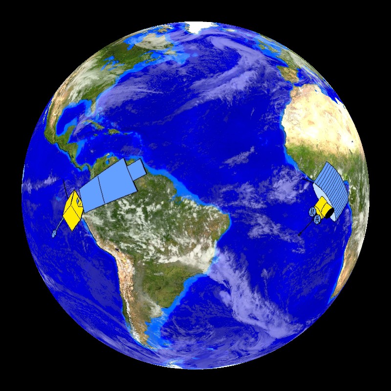
Geostationary satellites are a key tool for scientists to monitor and observe the Earth's atmosphere. They are called geostationary due to their movement. Geostationary satellites orbit around the Earth at the same rate as the Earth rotates so that the satellites are over the same spot on Earth all the time. This allows them to collect a continuous stream of data for one location so that "movies" of the data can be made. The satellites are positioned 22,300 miles above the Earth's surface in order to view the Earth's full disk and to maintain their geostationary orbit. Geostationary satellites travel at about 7000mph in order to maintain their geostationary orbit. Over the United States there are two such satellites, the GOES (Geostationary Operational Environmental Satellite) - East and GOES-West. There are many such satellites worldwide.
 Geostationary Satellite Scanning Pattern (1 mb)
There are two datasets that demonstrate how GOES satellites work. The first dataset shows the position of five geostationary satellites, whose images can be combined to make one global image. Each satellite is shown individually and then area that it is able to observe is highlighted. The images are combined at the end of the dataset to show the global satellite images that can be created using geostationary satellites. Notice that there are holes in the data at both of the poles. Polar orbiting satellites are used to collect data from the poles. The satellites shown in this dataset are NOAA's GOES-West at 135° West and GOES-East at 75° West, EUMETSAT's Meteosat-9 at 0° and Meteosat-7 at 57° East, and JMA's MTSAT at 140° East.
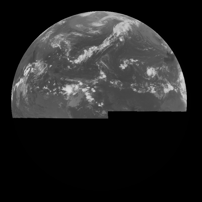
The second dataset shows how the geostationary satellites actually collect data. Satellites don't take pictures of the Earth, rather they collect data by scanning the Earth. The GOES satellites for the United States take approximately 26 minutes to scan the entire Earth. There are 2700 scan lines in an entire Earth image. This dataset is an animation that illustrates the data being collected in the scan lines. The satellites are able to scan from east to west and west to east. Future satellites will only take approximately 6 to 7 minutes to scan the Earth. The same animation is shown on both sides of the sphere.
Notable Features: Geostation Satellites
- Geostationary satellites are 22,300 miles above the Earth's surface and travel at 7000mph in order to maintain a geostationary orbit
- NOAA's GOES-West - 135° West
- NOAA's GOES-East - 75° West
- EUMETSAT's Meteosat-9 - 0°
- EUMETSAT's Meteosat-7 - 57° East
- JMA's MTSAT-1R - 140° East
- The poles are not covered by geostationary satellites
Notable Features: Geostationary Scanning
- Takes approximately 26 minutes to scan the entire Earth
- There are 2700 scan lines in an entire Earth Image
-
Data Category
Major:Atmosphere
Keywords:
NOAA, GOES, EUMETSAT, JMA, geostationary, satellites, scan lines
Data Set Name Geostationary Satellites Data Set Directory Name geo_sat Data Set Source Rick Kohrs, SSEC, Space, Science, and Engineering Center Data Set Developer Rick Kohrs, SSEC, Space, Science, and Engineering Center Visualization Developer Rick Kohrs, SSEC, Space, Science, and Engineering Center Audio No Contact Rick Kohrs, SSEC, Space, Science, and Engineering Center Download FTP
Data Set Name Geostationary Satellite Scanning Pattern Data Set Directory Name geo_scan Data Set Source Rick Kohrs, SSEC, Space, Science, and Engineering Center Data Set Developer Rick Kohrs, SSEC, Space, Science, and Engineering Center Visualization Developer Rick Kohrs, SSEC, Space, Science, and Engineering Center Audio No Contact Rick Kohrs, SSEC, Space, Science, and Engineering Center Download FTP