 Polar Orbiting Satellite Coverage from Feb 14, 2007 (2 mb)
NOAA Polar-Orbiting Operational Environmental Satellites
Description:
Satellites allow scientists to observe the Earth from above the atmosphere. The National Oceanic and Atmospheric Administration, NOAA, has several different types of satellites, including geostationary and polar orbiting satellites. These datasets show the path of Polar-orbiting Operational Environmental Satellites, or POES for short. NOAA has two POES in operation currently, a morning and afternoon satellite. The morning satellite crosses the equator on the sun-light side of the Earth in the morning, and the afternoon satellite crosses in the afternoon. Both satellites orbit the Earth 14.1 times per day.
 Sunsynchronous Satellite (3 mb)
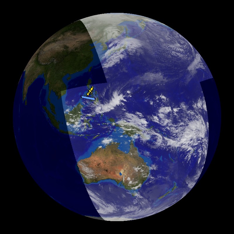
There are two datasets that show the NOAA POES, which are NOAA-17 and NOAA-18. The first dataset follows the path of NOAA-17, the morning satellite, and displays the IR data that the satellite collects over a 13 hour period on February 14, 2007. The IR data is overlaid on top of the NASA blue marble image. The satellite is able to provide full coverage of the Earth in less than 13 hours. POES satellites are about 510 miles above the Earth's surface and collect a swath of data that is 1740 miles wide. The second dataset follows NOAA-18 and shows the path of the satellite along with the day/night terminator for one day on December 22, 2007. NOAA-18 is the afternoon satellite, which crosses the equator in the afternoon. The satellite parallels the night-time side of the terminator. Each orbit for these satellites only takes 102 minutes. They are able to orbit the Earth so quickly because they are traveling almost 17,000 mph. If Science On the Sphere were the actual size of the Earth, the height of the POES orbit would be 4.5 inches above the surface.
Notable Features:
- Each orbit takes 102 minutes
- NOAA-17 is the morning satellite and NOAA-18 is the afternoon satellite
- The height of the orbit for the POES would be 4.5 inches above the surface of SOS
Data Category
Major:Atmosphere
Keywords:
NOAA, POES, polar-orbiting, satellites
| Data Set Name | Polar Orbiting Satellite Coverage from Feb 14, 2007 |
| Data Set Directory Name | poes_sat |
| Data Set Source | POES NOAA-17 |
| Data Set Developer | Rick Kohrs, SSEC, Space, Science, and Engineering Center |
| Visualization Developer | Rick Kohrs, SSEC, Space, Science, and Engineering Center |
| Audio | Yes |
| Contact | Rick Kohrs, SSEC, Space, Science, and Engineering Center |
| Download | FTP |
| Data Set Name | Sunsynchronous Satellite |
| Data Set Directory Name | sunsync_sat |
| Data Set Source | POES NOAA-18 |
| Data Set Developer | Rick Kohrs, SSEC, Space, Science, and Engineering Center |
| Visualization Developer | Rick Kohrs, SSEC, Space, Science, and Engineering Center |
| Audio | No |
| Contact | Rick Kohrs, SSEC, Space, Science, and Engineering Center |
| Download | FTP |