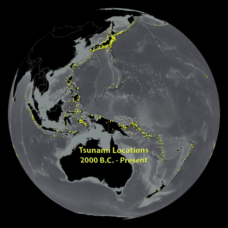
Tsunami Locations 2000 B.C. Through Present
Description:
Earthquakes, landslides, volcanoes, impacts from meteors - all of these disasters have caused tsunamis in the past. But by far, the most common generator of tsunamis is earthquakes, as has recently been seen in Sumatra, Chile, and Japan. The NOAA National Geophysical Data Center archives academic and historical reports from around the world of where tsunamis are estimated to have originated, and have compiled a database of over 2,400 events from 2,000 B.C. to the present. This image plots about half of those events - tsunamis that are classified as a "definite tsunam" or "probable tsunami." Since earthquakes are the most common tsunami generator, the highest density of event origins are located around the Pacific "Ring of Fire" known for its prevalence of volcanic and tectonic activity. The points are layered on top of a GEBCO map of ocean bathymetry, which indicates many of the pronounced ocean features, such as volcanic islands, rift zones, and plate boundaries that are often associated with generating tsunamis.
It should be noted that it is often difficult to validate the exact origin or cause of many ancient tsunamis, especially with the accuracy that is available with today's monitoring equipment. As a result, some tsunami origins seem landlocked. Many are due to coarse estimates of where a tsunami may have originated, or are associated with the closest city that recorded an event.
Other tsunami datasets available for SOS:
- Indian Ocean Tsunami
- Japan Tsunami
- Tsunami Movie
-
Notable Features:
- The highest density of tsunami origins is along the Pacific "Ring of Fire" due to high levels of earthquake activity, the most common trigger for tsunamis
- Only the events classified as "definite tsunami" and "probable tsunami" in the database were mapped, which totaled about 1100 of the 2400 events
- Tsunami origins that seem to be landlocked are coarse estimates based on historical records
Data Category
Major: Ocean
Keywords:
Ocean, tsunami, tectonics, bathymetry, earthquakes
Data Set Name Tsunami Locations Data Set Directory Name tsunami_locations Data Set Source NGDC's Tsunami Event Database Data Set Developer NOAA Environmental Visualization Laboratory Visualization Developer NOAA Environmental Visualization Laboratory Audio No Download FTP Date Added April 2011


 Tsunami Locations (12 mb)